How are drones used in agriculture? On Australian farms today, drones map paddocks, measure crop health, spray weeds, spread seed and fertiliser, check stock and water points, and even carry supplies across rough country. What once took a day in the ute can often be done in an hour from the air.
This guide answers how are drones used in agriculture with eight practical uses, the equipment behind each one, and the rules that apply. If you’re weighing up drones in agriculture for your own property, it will help you see where they fit and which aircraft in the Drones Direct range suit each job.
Why drones in agriculture are growing so fast
Drones in agriculture solve problems that every farmer knows: big areas, limited time, wet paddocks and rough terrain. A drone gives a bird’s-eye view instantly, and specialist aircraft can now apply chemicals or carry loads too.
- Speed. Survey large areas far faster than on foot or by vehicle.
- Access. Reach wet, steep or timbered country that machinery can’t.
- Precision. Target inputs to the exact areas that need them.
- Data. Build a record of crop and pasture condition over time.
- Safety. Keep people off steep slopes, out of water and away from hazards.
1. Crop mapping and scouting
The most common answer to how are drones used in agriculture is mapping. A drone flies a grid over a paddock, taking overlapping photos that software stitches into a detailed map.
Farmers and agronomists use these maps to spot poor emergence, weed patches, waterlogging, pest damage and machinery problems early. Regular flights show how a crop develops through the season, so problems are caught before they cost yield.
2. Multispectral crop health monitoring
Multispectral cameras capture light the human eye can’t see, including red edge and near-infrared. Healthy plants reflect these wavelengths differently from stressed plants, so multispectral maps reveal problems before they’re visible on the ground.
The DJI Mavic 3 Multispectral pairs a 20 MP RGB camera with four 5 MP multispectral cameras, and supports an RTK module for centimetre-level positioning. Its listing quotes up to 43 minutes of flight and the ability to cover large areas per flight, making it a strong tool for drones in agriculture programs focused on crop health.
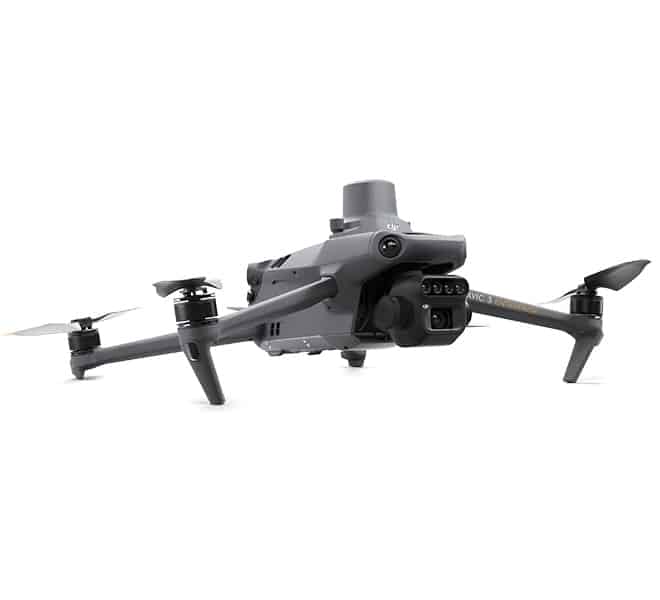
Using crop health maps
Crop health maps, such as NDVI maps, can be turned into prescription maps that guide variable-rate fertiliser or targeted spraying. That means inputs go where they’re needed, saving money and reducing waste.
3. Spraying crops and weeds
Spray drones apply herbicides, fungicides and insecticides from the air. They’re especially useful in wet paddocks, on slopes, around trees and for spot spraying weeds.
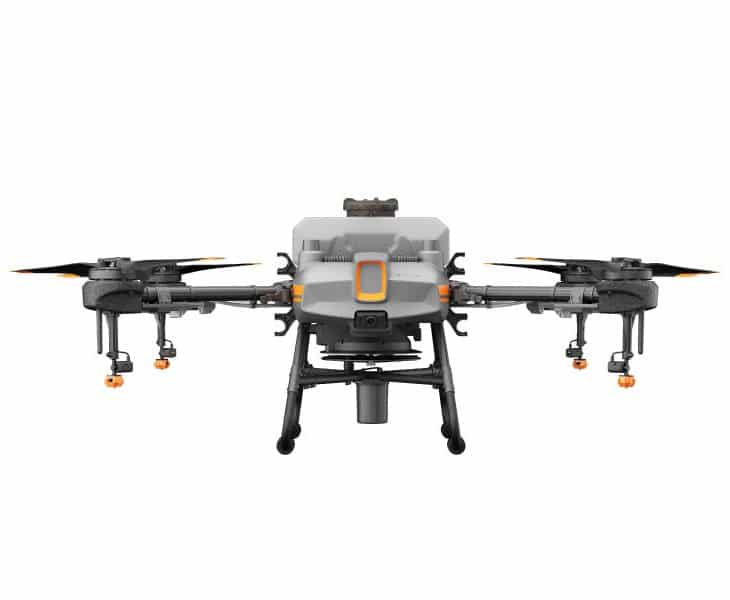
The DJI Agras T10 carries an 8 L tank with a spray width of up to 5 m. For a full guide to equipment, costs and licensing, read our article on drone spraying.
4. Spreading seed and fertiliser
With a spreading system fitted, the same drone can broadcast granules. The Agras T10 Spreading System 3.0 carries 8 kg of granules such as seed, fertiliser or feed.
Spreading by drone suits pasture renovation, cover crops, small blocks and areas too wet or steep for ground spreaders. It’s one of the most practical drones in agriculture uses for mixed farms.
5. Livestock checks
Checking stock across large properties takes hours. A drone can fly over paddocks to count animals, find strays, check on calving and lambing, and look for injured stock.
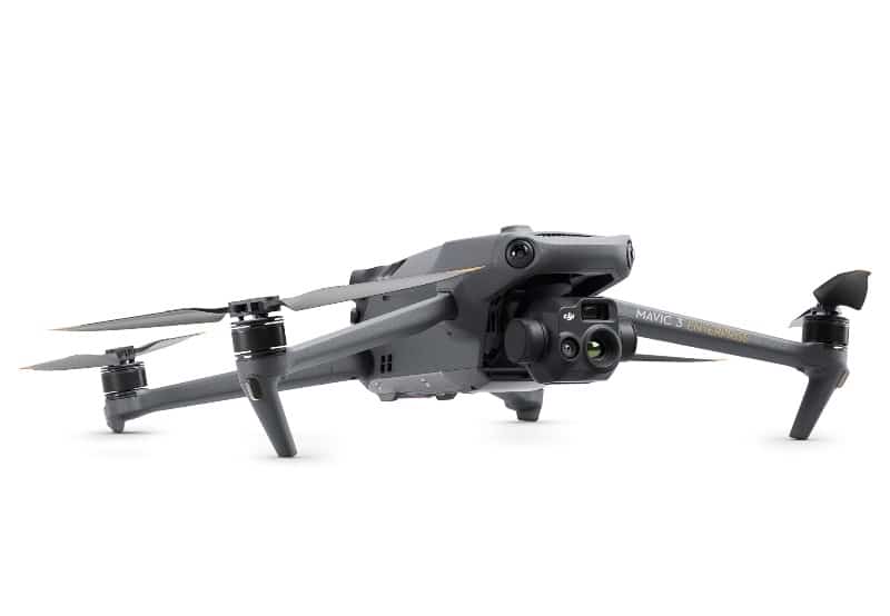
Thermal drones such as the DJI Mavic 3 Thermal make this even easier, because animals stand out clearly against cooler ground, especially early in the morning. Fly high and avoid hovering low over stock so animals aren’t stressed.
6. Water points, fences and infrastructure
Another answer to how are drones used in agriculture is infrastructure inspection. A quick flight checks troughs, tanks, dams, pumps and fence lines without driving every track.
Drones are also used to inspect sheds, silos, solar systems and irrigation equipment. Zoom cameras let you inspect details from a safe distance, and thermal cameras reveal overheating electrical components.
7. Surveying, drainage and earthworks
Survey-grade drones with RTK positioning create accurate elevation models. Farmers use them to plan drainage, contour banks, laser levelling, dams and roads.
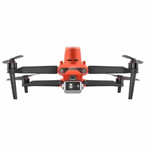
Aircraft such as the Autel EVO II Dual RTK Rugged Combo and the RTK-ready Mavic 3 series in our DJI Mavic 3 Enterprise range support this kind of mapping. Paired with software, the data helps plan works precisely.
8. Carrying supplies across the property
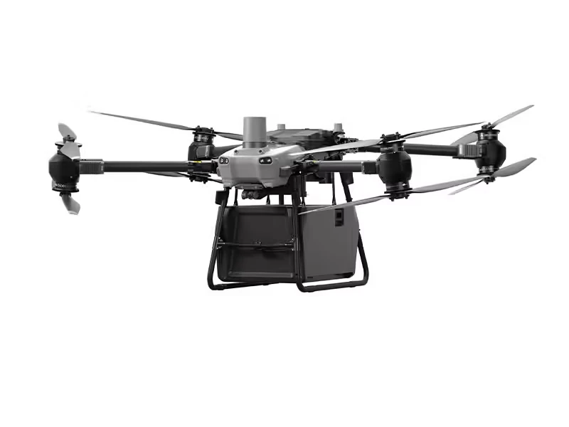
Heavy-lift delivery drones are a newer answer to how are drones used in agriculture. They carry tools, parts, samples or supplies across rivers, gullies and rough country where vehicles struggle.
The DJI FlyCart 30 is a heavy-lift delivery drone. DJI quotes a maximum payload of 40 kg and a maximum flight range of 28 km under specific conditions, and the optional winch system lowers loads without landing.
Drones in agriculture at a glance
| Use | What it does | Suitable equipment |
|---|---|---|
| Crop mapping | Detailed maps of emergence, weeds and damage | Camera or mapping drone |
| Crop health | Detects plant stress early | Mavic 3 Multispectral |
| Spraying | Targeted chemical application | DJI Agras T10 |
| Spreading | Seed, fertiliser and feed | Agras T10 Spreading System 3.0 |
| Livestock | Counting, finding and checking stock | Mavic 3 Thermal |
| Infrastructure | Troughs, tanks, fences, solar | Camera, zoom or thermal drone |
| Surveying | Elevation models for drainage and earthworks | RTK drone such as the EVO II Dual RTK |
| Delivery | Moving supplies across rough country | DJI FlyCart 30 |
Drones in agriculture by farm type
The best uses vary between enterprises. Here’s how drones in agriculture fit different types of Australian farms.
Grain and broadacre farms
Grain growers use drones for in-season crop scouting, weed mapping and spot spraying. Multispectral maps help target fertiliser and fungicide, while spray drones tackle weed patches, wet areas and headlands without driving through the crop.
Beef and sheep properties
On grazing properties, drones in agriculture are mostly about time. Checking water points, fences and stock from the air saves hours of driving, and thermal drones help find animals in scrub or long grass.
Dairy farms
Dairy farmers use drones to monitor pasture growth, check irrigation and inspect infrastructure. Spreading drones can help with pasture renovation on small or wet paddocks.
Horticulture, orchards and vineyards
High-value crops benefit from precise monitoring. Drones map vigour across blocks, help plan canopy management and apply targeted sprays on slopes and in tight rows.
Sugar cane, cotton and irrigated cropping
In irrigated systems, drones reveal uneven watering, drainage problems and pest hot spots. Survey drones with RTK also help plan field layouts and drainage.
Choosing the right drone for your farm
| Farm need | Type of drone | Example in our range |
|---|---|---|
| Crop health and variable-rate inputs | Multispectral mapping drone | DJI Mavic 3 Multispectral |
| Spraying and spreading | Agricultural spray drone | DJI Agras T10 |
| Stock checks and night work | Thermal drone | DJI Mavic 3 Thermal |
| Surveying and drainage | RTK mapping drone | Autel EVO II Dual RTK |
| Moving supplies | Heavy-lift delivery drone | DJI FlyCart 30 |
| General checks and photos | Compact camera drone | Camera drones |
Many farms start with a compact camera or thermal drone for everyday checks, then add specialist aircraft as needs grow.
Turning drone data into decisions
Drones in agriculture produce a lot of images. The value comes from turning them into decisions.
- Capture consistently. Fly the same routes at the same time of day so maps can be compared over time.
- Process the data. Mapping software stitches images into orthomosaics, elevation models and crop health maps.
- Interpret the results. Agronomists and farm managers identify problem zones and their likely causes.
- Ground-truth. Walk the problem areas to confirm what the map shows.
- Act. Create prescription maps for spraying, spreading or fertiliser, or plan repairs and works.
- Review. Compare results after treatment to measure the benefit.
A seasonal calendar for drones in agriculture
| Season | Common drone tasks |
|---|---|
| Pre-sowing | Survey paddocks, plan drainage, map weed patches |
| Sowing and emergence | Check establishment, spread seed in wet or small areas |
| In-crop | Monitor crop health, spot spray weeds, check for pests |
| Pre-harvest | Assess crop maturity and yield variability |
| Post-harvest | Map stubble, plan next season, inspect infrastructure |
| Year-round | Stock checks, water points, fences and shed inspections |
What it costs and where the savings come from
The cost of drones in agriculture ranges from affordable camera drones for basic checks to significant investments in spray, multispectral and heavy-lift aircraft. Training, licences, software and batteries add to the total.
Savings usually come from:
- Less driving and labour for routine checks.
- Earlier detection of pests, disease and water problems.
- Targeted inputs that cut chemical and fertiliser use.
- Timely operations when paddocks are too wet for machinery.
- Reduced crop damage from fewer wheel tracks.
Track the time and inputs saved in your first season to judge the return on investment.
Common challenges and how to solve them
- Learning the technology. Start with simple tasks and build skills before moving to complex mapping or spraying.
- Managing data. Choose software early and decide who will interpret the results.
- Battery logistics. Specialist drones need several batteries and reliable power in the paddock.
- Weather. Wind and rain limit flying, so plan around suitable windows.
- Regulations. Confirm CASA and state requirements before buying, especially for spraying.
Rules for drones in agriculture
Drones in agriculture follow CASA’s rules, and some uses need extra licences.
- Flying over your own land, unpaid, under 25 kg: generally requires drone registration and an RPA operator accreditation.
- Heavier drones over your own land: generally require a remote pilot licence (RePL).
- Paid work for others: generally requires a RePL and a remote operator’s certificate (ReOC), or flying under someone who holds one.
- Chemical application: each state regulates aerial spraying separately, and many require a chemical rating licence even on your own land.
Standard operating conditions still apply, including flying below 120 m, keeping the drone within sight and staying clear of people. Check CASA’s drone rules and your state agriculture department before starting.
Weather and timing for farm drone work
Weather affects every drone job on the farm, and timing changes the quality of the data you collect.
- Mapping: fly around the middle of the day for even light and short shadows, and avoid patchy cloud that creates uneven maps.
- Multispectral: use a sunlight sensor or calibration panel so readings are consistent between flights.
- Thermal stock checks: early morning gives the best contrast between animals and the ground.
- Spraying: follow the chemical label on wind, temperature and inversion conditions.
- Delivery and spreading: check wind speed and gusts against the aircraft’s limits, especially with heavy loads.
Rain, strong wind and very high temperatures all reduce flight time and performance, so build some flexibility into your plans.
Data security and privacy
Farm maps and imagery can reveal valuable information about your operation. Store data securely, decide who can access it and check how any cloud software handles your files. When flying near neighbours, respect their privacy and avoid capturing images of homes and people.
Safety around stock, people and machinery
Farms are busy places, and drones add a new hazard. A few habits keep everyone safe.
- Brief family members and workers before flying, especially near yards and sheds.
- Keep drones high and moving when flying over livestock to avoid stress.
- Stay clear of powerlines, which are hard to see from the air.
- Never fly over people working in paddocks or yards.
- Store batteries safely and charge them away from flammable materials.
Skills and training
Flying a camera drone is quick to learn, but drones in agriculture often involve mapping software, data interpretation and, for spraying, chemical handling. Investing in training pays off in better results and fewer mistakes.
Consider formal pilot training such as a RePL if you plan to fly heavier aircraft, spray chemicals or work for others. Many agronomists and rural suppliers also offer training on interpreting crop health maps.
Working with agronomists and contractors
You don’t have to do everything yourself. Many farms combine their own drone for everyday checks with contractors for spraying and agronomists for map interpretation.
When working with others, agree on who flies, who owns the data, what formats are needed and how results will be reported. Shared, consistent data makes advice more accurate.
The future of drones in agriculture
Drones in agriculture are evolving quickly. Automated docking stations that launch, land and recharge drones on a schedule are being trialled on farms. Regulators are also working on frameworks for flying beyond visual line of sight and for operating several spray drones at once with the right approvals.
As these changes arrive, expect more automated monitoring, faster spraying over larger areas and closer links between drone data and farm management software.
Getting started with drones in agriculture
- List your problems. Start with the jobs that cost you the most time or money.
- Match the drone to the job. A mapping drone, a thermal drone and a spray drone are very different tools.
- Check the rules. Confirm the CASA category and any state licences you need.
- Get trained. Training improves safety and results, and is required for some operations.
- Plan your data workflow. Decide what software you’ll use and who will interpret the maps.
- Start small. Trial one use, measure the benefit, then expand.
How are drones used in agriculture FAQ
How are drones used in agriculture in Australia?
Australian farmers use drones for crop mapping, crop health monitoring, spraying, spreading, livestock checks, infrastructure inspections, surveying and delivering supplies across rough country.
Are drones in agriculture worth the cost?
For many farms, yes. Savings come from earlier problem detection, targeted inputs, less driving and the ability to work in wet or steep paddocks. The best value comes from matching the drone to your biggest problems.
Do I need a licence to use a drone on my farm?
It depends on the drone’s weight, whether you’re paid and what you’re doing. Smaller drones over your own land may only need registration and accreditation, while heavier drones and chemical spraying need extra licences.
What is the best drone for crop monitoring?
A multispectral drone like the DJI Mavic 3 Multispectral is designed for crop health monitoring, combining an RGB camera with multispectral sensors.
Can drones count livestock?
Yes. Camera and thermal drones can count and locate livestock, and thermal imaging makes animals easy to spot in long grass or scrub.
Can drones work in wet paddocks?
Yes. Because they never touch the ground, drones can map, spray and spread in paddocks too wet for tractors, which is one of their biggest advantages.
How much training do I need?
Basic camera drones need only a short learning period plus CASA’s rules. Heavier aircraft, chemical spraying and paid work need formal training and licences, so check the requirements for your plans.
Explore drones in agriculture at Drones Direct
So, how are drones used in agriculture? In almost every part of the farm, from the crop to the stock to the infrastructure. Start with the job that costs you the most, choose the right aircraft and build from there.
Explore the DJI Agras T10, DJI FlyCart 30 and enterprise drones ranges, or contact the team through the drone shop.