Enterprise drones
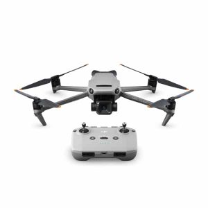
DJI Mavic 3 Multispectral
$7,919.00
In stock
- Free shipping over $1,000 Australia-wide. Orders usually ship within 1–2 days once confirmed.
- Secure checkout Encrypted payment
- Expert advice Help choosing the right gear
The DJI Mavic 3 Multispectral is a compact survey drone for farmers, agronomists and land managers who want to see crop health in detail. It pairs a 20 MP RGB camera with four 5 MP multispectral cameras and an RTK module. Order it online here and turn your paddocks into data you can act on.
Why growers choose the DJI Mavic 3 Multispectral
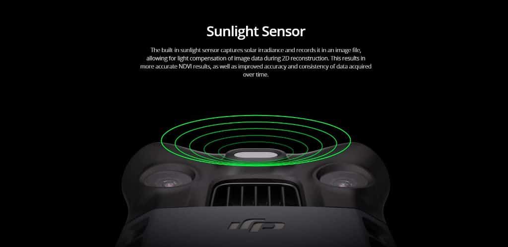
Problems in a crop often show up in plant reflectance before the eye can spot them. The DJI Mavic 3 Multispectral captures green, red, red edge and near-infrared bands, so software such as DJI Terra can build NDVI and other vegetation index maps. Those maps help you target inputs where they’re needed.
With the RTK module, the DJI Mavic 3 Multispectral can survey accurately without ground control points, saving setup time on every paddock. Terrain-follow surveying also handles orchards and steep slopes.
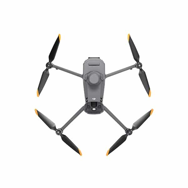
DJI Mavic 3 Multispectral
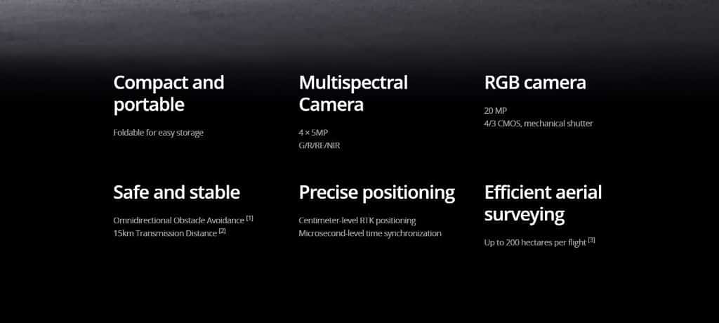
Effective aerial surveying needs to see the invisible. That’s why Mavic 3 Multispectral has two forms of sight. It combines an RGB camera with a multispectral camera to scan and analyse crop growth with total clarity. Agricultural production management requires precision and data, and Mavic 3M delivers both.
Multispectral + RGB imaging system
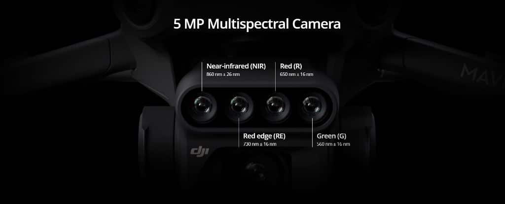
Highly integrated imaging system
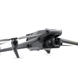
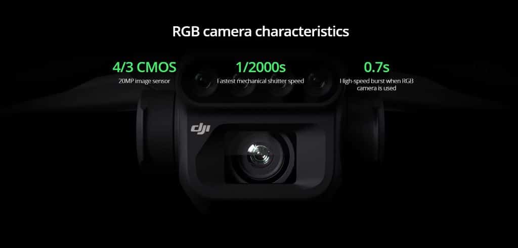
Newly upgraded imaging system with one 20MP RGB camera and four 5MP multispectral cameras (green, red, red edge, and near-infrared). Enables applications such as high-precision aerial surveying, crop growth monitoring, and natural resource surveys.
RTK module
Accurate images that capture every pixel
Mavic 3M with RTK module for centimetre-level positioning. Flight control, the camera, and the RTK module sync in microseconds to accurately capture the location of each camera’s imaging centre. This enables Mavic 3M to do high-precision aerial surveying without using ground control points.
Ultra-long battery life, fast bursts
43 minutes [4]
Cruise time
200 hectare [3]
A single flight can complete mapping operations over an area of 200 hectares.
Fast charging
100W Battery Charging Hub
High-efficiency fast charging
88W fast charging
Aircraft
Stable signal, smooth image transmission
The O3 transmission integrates two transmitting signals and four receiving signals to support 15km ultra-long transmission distances.
Omnidirectional obstacle sensing [1], terrain-follow aerial surveying
The aircraft features multiple wide-FOV vision sensors that accurately detect obstacles in all directions for omnidirectional obstacle avoidance. The terrain-follow aerial surveying can be easily performed in steep-slope landscapes.
Applications
Orchard mapping
Mavic 3M allows terrain-follow aerial surveying of orchards, even on sloped landscapes. Together with DJI Terra or DJI SmartFarm Platform [6] to reconstruct high-resolution orchard maps, automatically identify the number of trees, distinguish trees from other obstacles or objects, and generate three-dimensional operation routes for agricultural drones, making operations safer and more efficient.
DJI Mavic 3 Multispectral coverage and turnaround
A single flight can map around 200 hectares, and the DJI Mavic 3 Multispectral offers up to 43 minutes of cruise time. The 100 W charging hub keeps batteries rotating, so you spend less time waiting between flights.
- Variable-rate prescription maps for spraying drones
- Field scouting for weeds, poor emergence and lodging
- Orchard mapping and tree counting
- Environmental and natural resource surveys
Built for your workflow
The DJI Mavic 3 Multispectral works with DJI Terra and the DJI SmartFarm Platform, and the Cloud API and Mobile SDK 5 let developers connect it to third-party systems or build custom apps.
Frequently asked questions
What bands does the DJI Mavic 3 Multispectral capture?
It has four 5 MP multispectral cameras covering green, red, red edge and near-infrared, plus a 20 MP RGB camera for standard images. Together they support crop health analysis and visual mapping.
Do I need ground control points with the DJI Mavic 3 Multispectral?
With its RTK module, the drone can carry out high-precision surveying without ground control points, because the flight controller, camera and RTK module sync to record each image’s position accurately.
How much can the DJI Mavic 3 Multispectral cover in one flight?
DJI rates a single flight at mapping operations over about 200 hectares. Actual coverage depends on overlap settings, altitude, wind and terrain, so plan conservatively for your first jobs.
Can your team help me plan an ag drone setup?
Yes. Chat with us on the site about software, batteries and accessories for your operation. Checkout is secure, shipping is calculated at checkout and orders go straight to you.
Pairs well with the DJI Mavic 3 Multispectral
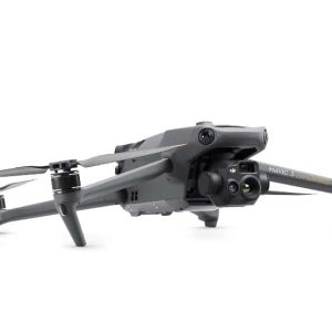 DJI Mavic 3 Thermal 2 Yr Basic Shield
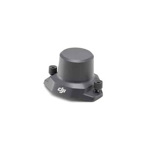 DJI Mavic 3 Enterprise Series RTK Module
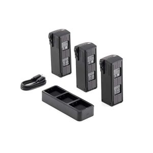 DJI Mavic 3 Enterprise Series Battery Kit
Make smarter decisions about every paddock. Add the DJI Mavic 3 Multispectral to your cart today, or chat with our team about your survey workflow.
Explore more DJI Mavic 3 Enterprise or browse the full Drones Direct range. Full specifications and support for the DJI Mavic 3 Multispectral are on the DJI website. Before you fly, review CASA’s drone safety rules.
More like this
Related gear