A thermal drone sees heat instead of light. By pairing a thermal imaging camera with a stable flying platform, a thermal drone can spot a missing person in scrub, a failing solar panel on a roof or a hot spot in a bushfire long before the human eye could.
This guide explains how a thermal drone works, where it pays for itself, what specs matter when you compare models, and the CASA rules that apply in Australia. We also compare the thermal drone options in the Drones Direct enterprise drones range so you can shortlist the right aircraft for your work.
How does a thermal drone work?
Every object gives off infrared radiation, and warmer objects give off more of it. A thermal camera uses a sensor called a microbolometer to measure that radiation and turn it into an image, where differences in temperature appear as differences in colour or brightness.
Mount that camera on a drone and you get a bird’s-eye heat map of whatever you fly over. Most professional thermal drone models also carry a regular visual camera, and often a zoom camera, so you can switch between heat and detail in the same flight.
Thermal vs visual cameras
| Feature | Visual camera | Thermal camera |
|---|---|---|
| What it detects | Reflected visible light | Emitted infrared heat |
| Works in darkness | No | Yes |
| Sees through smoke | Poorly | Better, depending on conditions |
| Typical resolution | 12 MP to 48 MP and up | Commonly 640 × 512 pixels |
| Sees through walls or glass | No | No: glass blocks most thermal infrared |
That last row surprises many people. A thermal drone can’t see through walls, and glass reflects thermal energy, so readings through windows aren’t reliable.
What a thermal drone is used for
The value of a thermal drone comes from finding problems faster and more safely than people on foot. These are the most common jobs in Australia.
Search and rescue
Body heat stands out clearly against cooler ground, especially at dawn, dusk and night. Emergency services and volunteer groups use a thermal drone to sweep large areas of bush, farmland or coastline in a fraction of the time a ground search takes.
Firefighting and hazard reduction
Thermal imaging helps crews find hot spots and smouldering ground after a fire front has passed. A thermal drone can also monitor burn-offs and check that a fire is fully out before crews leave.
Solar farm and roof inspections
Faulty solar cells run hotter than healthy ones. A thermal drone can scan rows of panels quickly, while roof inspectors use the same approach to find moisture, insulation gaps and failing seals.
Electrical and infrastructure inspections
Overheating joints, transformers and connections show up clearly in thermal images. Inspecting powerlines, substations and switchboards from the air keeps workers away from live equipment and heights.
Agriculture and livestock
Farmers use a thermal drone to find stock in paddocks, check water points and look for animals that have strayed. It’s also used to spot irrigation problems and areas of crop stress.
Wildlife surveys and pest management
Researchers use thermal imaging to count animals such as koalas and kangaroos at night without disturbing them. Land managers also use a thermal drone to locate feral pests like pigs and foxes ahead of control programs.
Can you use a thermal drone for hunting?
“Thermal drone for hunting” is a popular search, so it’s worth addressing directly. Using a drone to locate pest animals for an authorised control program is common on farms. However, hunting and animal control are regulated by each state and territory, and rules on using drones and thermal equipment differ.
Before using a thermal drone for any animal control, check your state’s hunting and animal welfare laws, the property’s permissions and CASA’s drone rules. Commercial pest control work also needs the right CASA accreditation or licence.
Key specs to compare in a thermal drone
Not all thermal cameras are equal. These are the numbers that separate a capable thermal drone from a basic one.
- Thermal resolution. 640 × 512 is the professional standard. Lower resolutions such as 160 × 120 suit close-range work but show far less detail at a distance.
- Radiometric data. A radiometric thermal drone records the temperature of every pixel, so you can measure readings afterwards. This is essential for inspection reports.
- Thermal sensitivity (NETD). A lower NETD figure means the camera can tell smaller temperature differences apart.
- Zoom. Optical and hybrid zoom on the visual camera let you identify what the thermal camera has found from a safe distance.
- Laser rangefinder. Some models measure the distance and position of a target, which is valuable for search and rescue coordinates.
- Flight time. Longer flights mean bigger search areas per battery. Check rated times and plan for less in real conditions.
- Weather resistance. An IP rating tells you how well the drone handles rain and dust.
The best thermal drone options at Drones Direct
Each model below suits a different type of operator. Match the thermal drone to your typical job, budget and team size.
DJI Matrice 4T
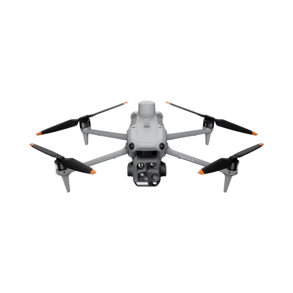
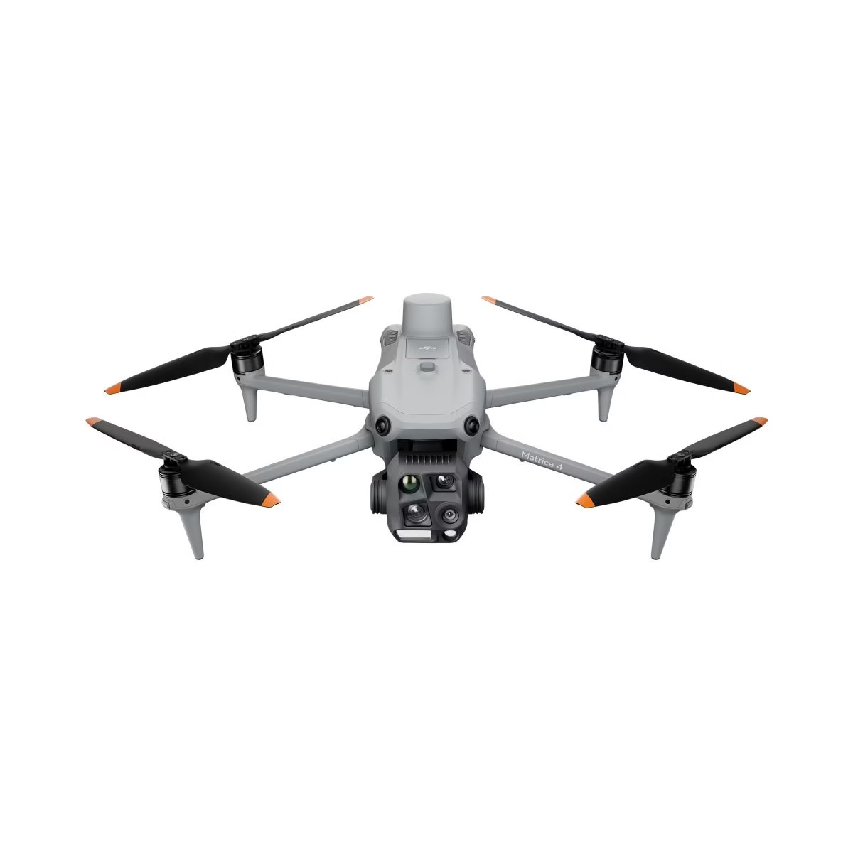
The DJI Matrice 4T is a compact enterprise thermal drone with a 640 × 512 thermal camera, wide, medium tele and tele visual cameras, and a laser rangefinder. It folds for transport and is rated for long flight times, making it a strong all-rounder for public safety and inspection teams.
Explore the full DJI Matrice 4 series for related configurations.
DJI Mavic 3 Thermal
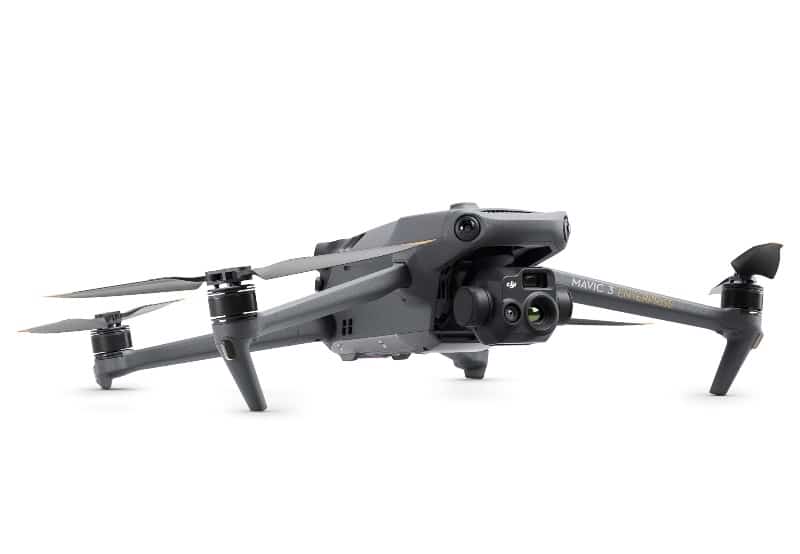
The DJI Mavic 3 Thermal packs a 640 × 512 thermal camera, a 48 MP wide camera and a zoom camera into a folding Mavic body. It’s a portable thermal drone that one person can carry and deploy quickly, ideal for farms, councils and inspection contractors.
It’s available with a one-year or two-year Basic Shield plan, and our DJI Mavic 3 Enterprise range covers related models.
DJI Matrice 30T
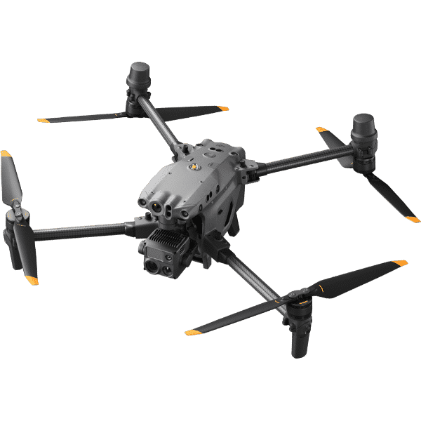
The DJI Matrice 30T is a rugged, weather-resistant thermal drone built for demanding missions. It combines a 640 × 512 thermal camera with zoom and wide cameras and a laser rangefinder, and its IP55 rating lets it keep working in rain and dust.
It’s a larger aircraft suited to emergency services and utilities. See the Matrice M30 series for batteries and accessories.
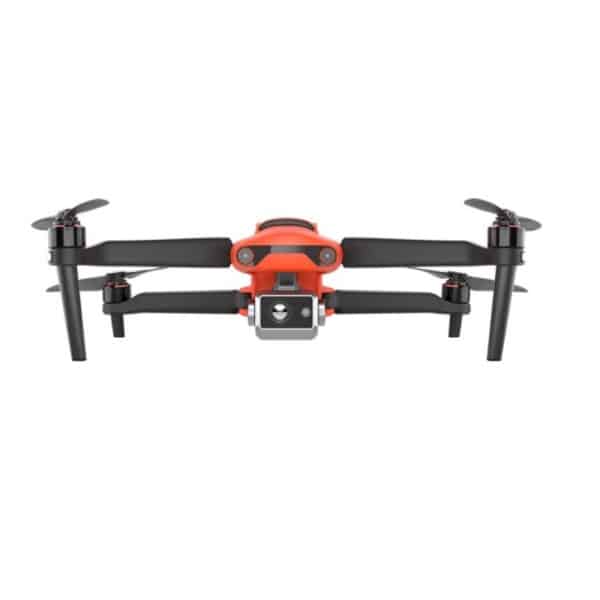
Autel EVO II Dual 640T V2
The Autel EVO II Dual 640T V2 Rugged Bundle pairs a 640 × 512 radiometric thermal camera with a high-resolution visual camera. The rugged bundle includes a hard case and extras, making it a complete thermal drone kit for field teams.
For mapping and survey accuracy, the EVO II Dual RTK Rugged Combo adds RTK positioning.
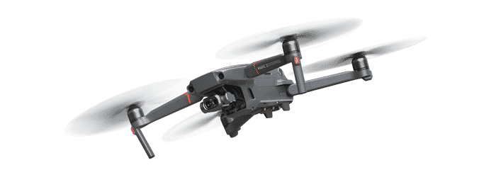
DJI Mavic 2 Enterprise Dual
The DJI Mavic 2 Enterprise Dual is an entry-level thermal drone with a compact FLIR thermal sensor alongside a 4K visual camera. Its lower thermal resolution suits close-range jobs such as roof checks and small property inspections.
Thermal drone comparison
| Model | Thermal resolution | Laser rangefinder | Best for |
|---|---|---|---|
| DJI Matrice 4T | 640 × 512 | Yes | All-round public safety and inspection |
| DJI Mavic 3 Thermal | 640 × 512 | No | Portable farm and inspection work |
| DJI Matrice 30T | 640 × 512 | Yes | Rugged emergency and utility missions |
| Autel EVO II Dual 640T V2 | 640 × 512 | No | Field teams wanting a complete kit |
| DJI Mavic 2 Enterprise Dual | 160 × 120 | No | Close-range, entry-level jobs |
Thermal drone rules in Australia
Most thermal drone work is commercial, so business rules apply. CASA requires drones flown for business to be registered, and the pilot needs at least an RPA operator accreditation for drones up to 2 kg.
Heavier aircraft, or work outside the standard operating conditions, generally needs a remote pilot licence (RePL) and an operator’s certificate (ReOC), or flying under another organisation’s ReOC. Night flying, which is common for thermal work, sits outside the standard conditions and needs specific CASA approval.
- Fly no higher than 120 m above ground level.
- Keep the drone within visual line of sight.
- Stay 30 m from people and don’t fly over them.
- Fly during the day unless you hold night approval.
- Stay clear of controlled aerodromes and emergency operations unless authorised.
Always confirm the latest requirements on CASA’s drone rules before you start work.
Getting good results from a thermal drone
The best thermal images come from good timing and good technique, not just good hardware.
- Fly at the right time. Temperature contrast is usually strongest early in the morning or after dark, before the sun heats everything evenly.
- Watch for reflections. Shiny metal, water and glass reflect heat from the sky and the sun, which can look like false hot spots.
- Set the right palette. White-hot or black-hot palettes are clearest for search work, while colour palettes help with inspections.
- Use isotherms and alarms. Many thermal drone apps can highlight a temperature range or alert you when something exceeds a set value.
- Keep a consistent distance. For inspections, fly at a steady height and angle so readings are comparable.
- Capture visual and thermal together. Paired images make reports far easier to understand for clients.
Thermal colour palettes explained
The same heat data can be displayed in different colour palettes. Choosing the right one makes targets easier to spot and reports easier to read.
| Palette | How it looks | Best for |
|---|---|---|
| White hot | Warm objects white, cool objects black | Search and rescue, finding people and animals |
| Black hot | Warm objects black, cool objects white | Reducing glare and eye strain on long searches |
| Ironbow | Purple to orange to yellow | Inspections and client reports |
| Rainbow | Full colour spectrum | Showing small temperature differences |
| Red hot | Grey image with the hottest areas in red | Highlighting hot spots quickly |
Most pilots switch palettes during a flight. White hot often finds a target fastest, then ironbow or rainbow helps explain what you’ve found.
Setting up a drone program for your organisation
Buying the aircraft is only the first step. Councils, emergency services, farms and contractors get the most value when they build a simple, structured program around it.
- Define the jobs. List the tasks the aircraft will do, how often, and what output each one needs, such as a search log, an inspection report or a map.
- Choose the right approvals. Work out whether your pilots need an operator accreditation, a RePL, or to operate under an ReOC, and whether you need night or controlled-airspace approvals.
- Train your pilots. Thermal interpretation is a skill. Pair flight training with practice reading heat patterns on the equipment you’ll actually inspect.
- Write procedures. Standard operating procedures cover pre-flight checks, emergency responses, battery handling and data storage.
- Plan maintenance. Track flight hours, battery cycles and firmware updates, and schedule regular checks.
- Review and improve. After each job, note what worked and what didn’t, then update your procedures.
A clear program also makes it easier to win work. Clients increasingly ask contractors to show procedures, insurance and pilot qualifications before a job starts.
Managing thermal data and reports
Thermal images are only as useful as the reports you build from them. Good data habits save hours later and make your findings more credible.
- Name and sort files consistently. Use the site, date and asset in every folder name.
- Record conditions. Note the air temperature, wind, cloud cover and time of day, because they all affect readings.
- Set emissivity correctly. Different materials emit heat differently. Use the correct setting for the surface you’re measuring.
- Pair images. Keep each thermal image with its matching visual image so readers can see exactly where the problem is.
- Use analysis software. Radiometric files can be opened in dedicated software to measure spots, areas and temperature differences.
- Back up promptly. Copy data off the aircraft at the end of each day and store it securely, especially if it contains sensitive sites.
Accessories that keep you flying
Long thermal missions burn through batteries quickly. Extra batteries and a fast charging station keep the aircraft working through a shift.
For the Matrice 30 series, our range includes the TB30 Intelligent Battery and BS30 Battery Station. Protective cases, spare propellers and portable power, such as units from our EcoFlow portable power range, are worth budgeting for in the field.
How much does a thermal drone cost?
Thermal drone prices depend mostly on thermal resolution, zoom capability and ruggedness. Entry-level models with low-resolution sensors cost far less than enterprise aircraft with 640 × 512 cameras, laser rangefinders and IP ratings.
When budgeting, include spare batteries, a charging station, training and insurance. Enterprise care plans, like those bundled with some models in our range, also protect your investment. Our guide to buying a drone covers what else to check before you pay.
Choosing the right thermal drone
Ask these questions to narrow your shortlist.
- What’s the main job? Search and rescue favours zoom and rangefinders. Inspections need radiometric data.
- How far away will you be? Long-range work needs higher thermal resolution and zoom.
- Who will carry it? Portable folding models suit solo operators. Larger airframes suit teams.
- What conditions will you fly in? Rain, dust and wind call for an IP-rated thermal drone.
- Do you need survey accuracy? RTK positioning adds precision for mapping work.
Thermal drone FAQ
Can a thermal drone see through walls?
No. A thermal drone detects surface temperatures, so it can’t see through walls, roofs or glass. It can, however, show heat patterns on a surface caused by what’s behind it, such as leaks or insulation gaps.
Does a thermal drone work in daylight?
Yes. A thermal drone works day and night, but contrast is often better when the sun isn’t heating everything evenly, such as early morning or after dark.
Do I need a licence to fly a thermal drone?
For business use you need, at minimum, CASA registration and an operator accreditation for drones up to 2 kg. Heavier drones or work outside standard conditions usually needs a RePL and ReOC. Night flying needs specific approval.
What thermal resolution do I need?
For most professional work, 640 × 512 is the standard. Lower resolutions can work for close-range jobs, but they show much less detail at distance.
What is a radiometric thermal drone?
A radiometric thermal drone stores the temperature value for every pixel. That lets you measure exact temperatures afterwards, which is essential for inspection reports and audits.
How long can a thermal drone fly?
Flight times vary by model and payload. Enterprise models are typically rated for 40 minutes or more, but wind, cold and heavy use of zoom reduce real-world times.
Can a thermal drone find people at night?
Yes. Finding people at night is one of the most valuable uses of thermal imaging, because body heat stands out against cooler surroundings. Remember that night flying needs specific CASA approval, so most volunteer and emergency teams operate under an organisation with the right authorisations.
Is a thermal drone worth it for a farm?
For larger properties it often is. Locating stock, checking water points, finding injured animals and supporting pest programs can save many hours of driving and walking, especially in rough or timbered country.
Find your thermal drone at Drones Direct
A thermal drone turns hours of searching or inspecting into minutes, while keeping people out of harm’s way. Choose the Matrice 4T for an all-rounder, the Mavic 3 Thermal for portability, the Matrice 30T for rugged missions or the EVO II Dual 640T V2 for a complete field kit.
Compare models across our enterprise drones range, or contact the team through the drone shop for help choosing.